|
|
 |
The Wicklow Gap, Co. Wicklow, Republic of Ireland
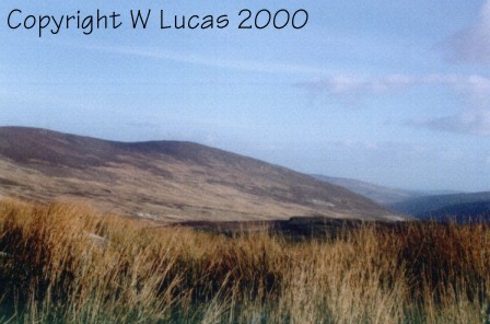
Perhaps some of you like to find out more about the three Glens in Wicklow - Glen of Imaal, Glenmalure and Glendalough. It is through these Glens the fighting against the British was done in 1798. All are situated in West Wicklow and although Glendalough is a tourist area now all three Glens were once hostile. At the head of the Glen of Imaal is the fort that the Yeomanry lived in when defending 'the black banks' to stop the Fenians escaping to Glenmalure. Glenmalure although now accessible is a wild wild place - a wilderness! Bounded by Mountains the Glen of Imaal has Lug na Cuille, Derrymuck and Table Mountain surrounding it and the only route for escaping from the Glen of Imaal was the Black Banks and they are still there. The Glen is owned by the State and is used as a firing range for the Irish Army to practice in [i.e., Stranokelly woods) which are out of bounds to visitors due to live ammunition being in the woods. Crossing Derrymuck to Glendalough leads to some very beautiful scenery and dangerous terrain - it is said that Michael Dwyer rested in St. Kevin's Bed (cave in rocks over the lake) when injured during the 1798 rising. At the head of Glendalough are miners cottages (ruins) and the glen was worked and the English miners lived in the cottages there.
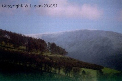
Lugnaquilla in snow - March 2000 Whether you like or not we have all a bit of English in us. My grandfather went down with his ship running the blockade for the English in 1916 - He was decorated by the Queens Grandfather - all my mother family died overseas, her brothers died with their father Captain Christopher Wall when the Anna Linsey was shelled by the Germans and went down. Two brothers came from Armagh on my fathers side (McGahan) one Went to Dundalk and the other to Wicklow town. One was a builder and the other a solicitor.
The western end opens towards the plains of Carlow. Southern side has mountains extending to near Carlow: Slievereegh, Keadeen, Carrig, Brusselstown Hill. to the North, Table Mount and Lugnaquilla the highest mountain in Leinster and on eastern side the town land of Camara.
Ireland's hillfort capital is Baltinglass, Co. Wicklow, the nearest town to the Glen of Imaal and the nearest village is Donard. There on the summit of Baltinglass Hill is an unfinished hillfort known as Rathcoran. To the north of this are the ramparts of the fort known as Rathnagee. North east of Baltinglass stand the Brusselstown Hillfort, this stone built enclosure surround the southern peaks of the Spinnans Hill. Aerial photographs taken by the Office of Public Works has provided information value to the Baltinglass group of hill hillforts. A large hillfort has been identified northwest of Baltinglass town. This is covered by a mature forest. A further complex of hillfort defences on Spinans hill has shown that the Brusselstown Ring rises from a hillfort to a complex hillfort of at least 230 acres in extent, making it the largest hillfort of its type.
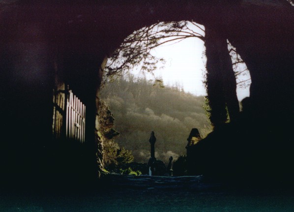
Ancient and spiritual site of Glendalough All photographs on this web page are the Property of Wendy Lucas ©Copyright Wendy Lucas 2000 MIDI file playing is 'Frost is all Over' copyright Richard Jordan 1996-7 from the Jordan O'Connell Celtic Midi Archive |